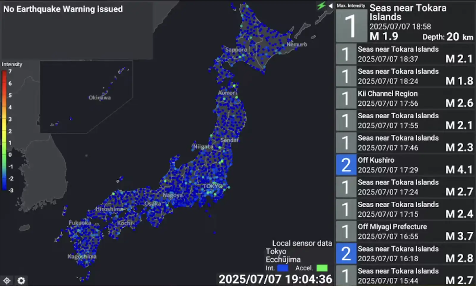
On Monday, July 7, a magnitude 3.9 earthquake struck a town in San Narciso, Quezon province while a 4.3 magnitude quake was recorded 171 kilometers off the coast of South Cotabato. In Japan, 900 earthquakes in the past two weeks have spooked residents off the Tokara islands, coinciding with the unscientific rumors of the earthquake predicted to hit the country this past weekend.
Japan and the Philippines enjoy high tourism rates, the Philippines with over 14.7 million foreign visitors and Japan with 36.9 million foreign visitors in 2024. Both countries also sit on the Pacific Ring of Fire, a belt around the Pacific Ocean prone to seismic activity like volcano eruptions, earthquakes, and tsunamis, so ensuring the safety of millions is paramount.
Over the years, Japan has taken big steps towards earthquake resilience, from mobile alert systems to adopting earthquake-resistant building standards. The Philippines, in contrast, is barely able to keep up.
Billion-peso projects are underway to retrofit infrastructure, like the Metro Manila Priority Bridges Seismic Improvement Project and the Philippines Seismic Risk Reduction and Resilience Project, which seeks to make 400 public buildings in NCR earthquake-resilient. But the country should also take smaller steps in the meantime to keep millions everyone safe — not just locals, but also tourists who are unfamiliar of the country they’re visiting.
Here are four things we can learn from Japan about earthquake and tsunami resilience.
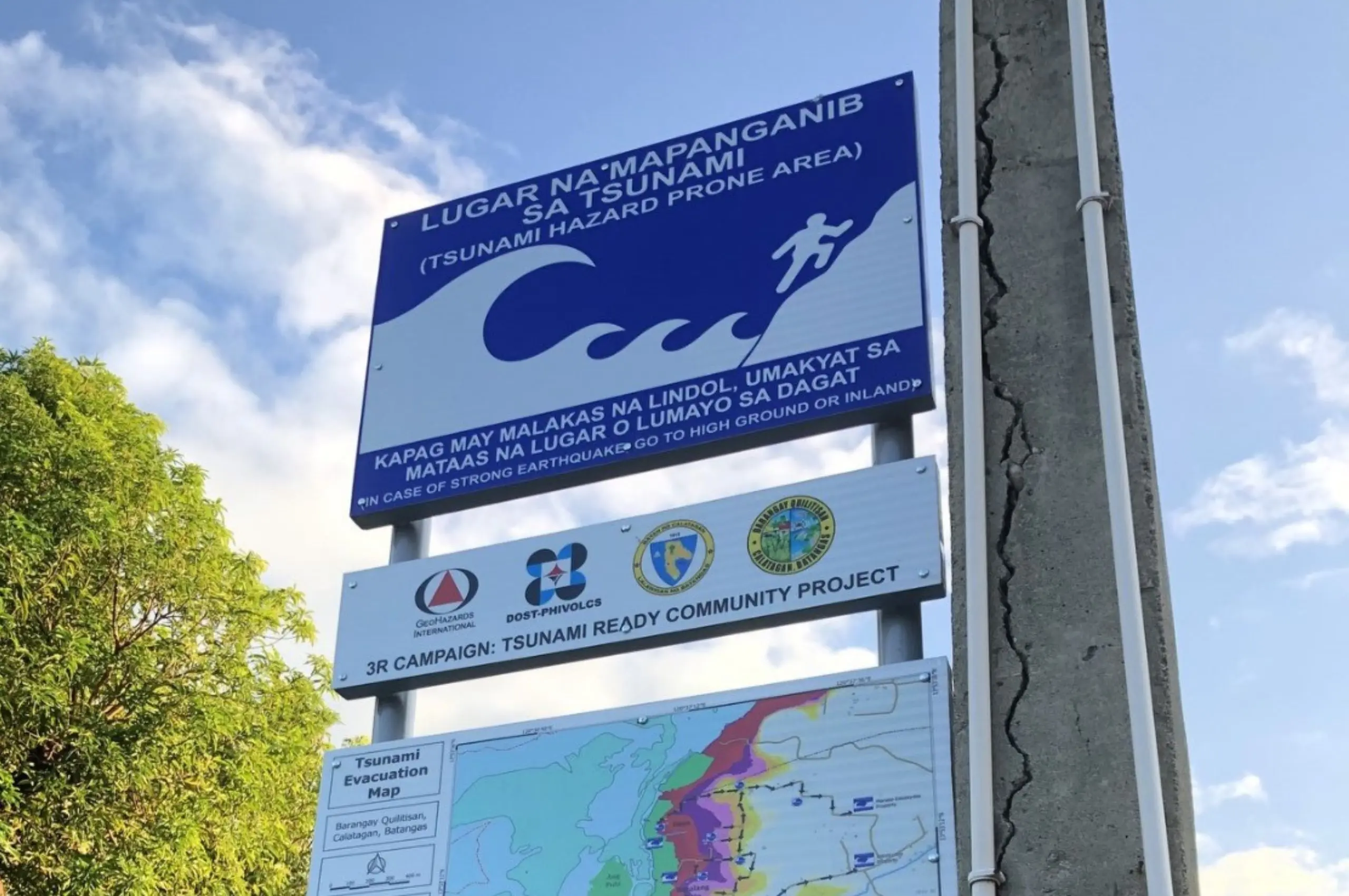
Multilingual Road Signs
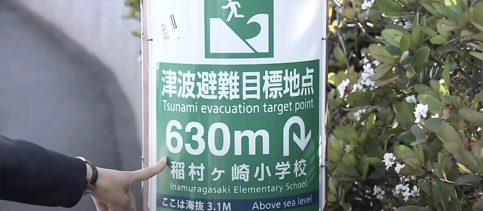
Japan installs standardized multilingual signs in Japanese, English, Chinese, and Korean to mark evacuation routes, hazard zones, and emergency shelters, especially in tourist-heavy coastal areas like Kamakura. These help non-Japanese speakers navigate the areas and locate safe zones.
Mobile Alert Systems for Visitors

Japan’s early warning system J-Alert sends real-time earthquake and tsunami warnings to all mobile phones, while the Safety Tips app also pushes alerts in English and other languages for foreign tourists.
The National Disaster Risk Reduction and Management Council (NDRRMC) also adopted a similar system through the Free Mobile Disaster Alerts Act, which is how we get weather and earthquake alerts on our phones. However, these alerts may be delayed by as late as five hours, making them less useful for those immediately affected by emergencies.
Public Service Announcements
Japan uses trains, airports, and tourist centers to broadcast public service announcements (PSAs) with basic disaster safety tips. These often include animated videos or posters on earthquake and tsunami response, designed to be language-neutral and subtitled in other languages.
In the Philippines, similar PSAs for earthquake safety do exist, but they are not consistently or widely broadcast in public spaces. While these PSAs exist on TV, radio, and social media, the Philippines lacks standardized videos and posters in places like train stations, airports, parks, and other areas that tourists frequent.
Accessible Evacuation Maps
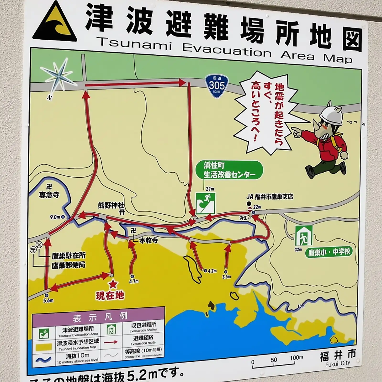
Evacuation maps in Japan are widely available at hotels, public buildings, train stations, and even vending machines. These maps use clear visuals and symbols to guide users to the nearest safe zones, and interactive versions are also accessible online.
The Philippine Institute of Volcanology and Seismology has a web portal people could use to look for site-specific hazard maps, but some maps aren’t available for certain areas.